February 15, 1904. Approximately 340,000 acres of land in the Santa Lucia Mountains of Monterey County are withdrawn from further settlement by the United States General Land Office, pending the establishment of the proposed Monterey Forest Reserve.
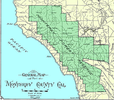
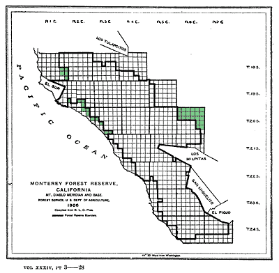
June 25, 1906. By a proclamation by President Theodore Roosevelt, the Monterey Forest Reserve is established.
NOTE: -- See "A Forest is Born by Proclamation" in the Winter 2000 edition of the Double Cone Quarterly to see facsimiles of the Presidential proclamations of 1906 - 1910 referred to in this article.
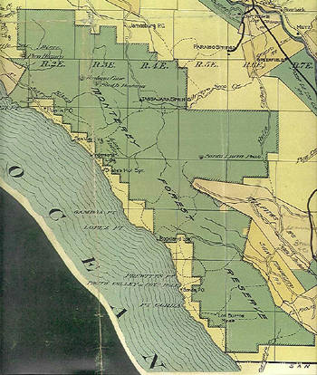
July 18, 1906. By a proclamation by Theodore Roosevelt, The Pinnacles Forest Reserve is established. The reserve was placed under the administration of the Monterey Forest Reserve.
March 4, 1907. By an act of Congress, all Forest Reserves are renamed National Forests.
October 26, 1907. By a proclamation by Theodore Roosevelt, the San Benito National Forest is established. Like The Pinnacles, the San Benito Forest was placed under the administration of the Monterey National Forest.
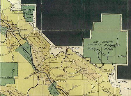
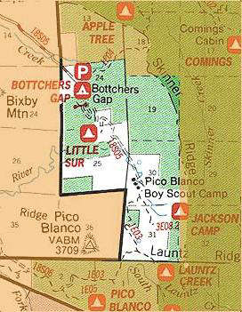
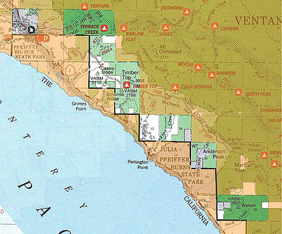
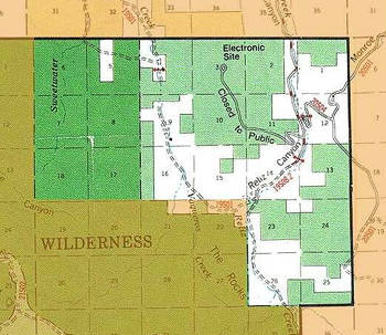
January 9, 1908. By a proclamation by President Theodore Roosevelt, about 25,000 acres in 39 land sections are added to the Monterey National Forest.
January 16, 1908. By a proclamation signed by Theodore Roosevelt, a portion of the Pinnacles Forest, i. e., the "jagged peaks known as The Pinnacles," is set aside as a national monument. The area remained under the administration of the Monterey National Forest.
July 2, 1908. By an executive order by Theodore Roosevelt, the Monterey, San Benito and Pinnacles National Forests are consolidated under the name Monterey National Forest.
December 12, 1910. By a proclamation by William Taft, the Pinnacles Division of the Monterey National Forest is eliminated from the National Forest system, and land is both added to and eliminated from the San Benito Division.
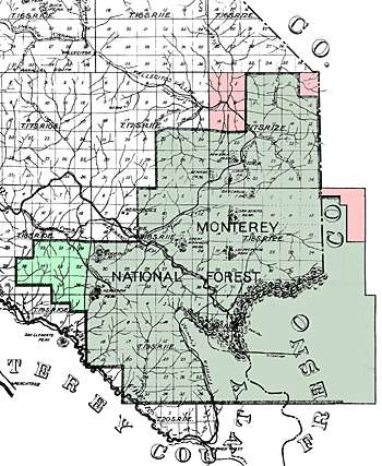
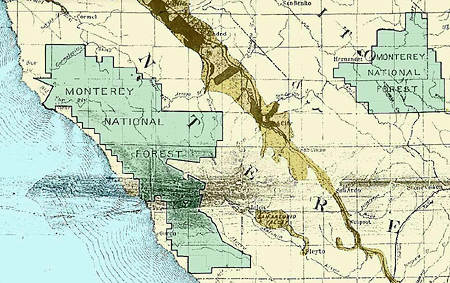
September 5, 1916. By an executive order by Woodrow Wilson, the San Benito Division of the Monterey National Forest is eliminated from the National Forest system.
August 18, 1919. By an executive order by President Woodrow Wilson, the Monterey and Santa Barbara National Forests are consolidated under the name Santa Barbara National Forest.
January 7, 1929. The Regional Forester in San Francisco sets aside the Ventana Wild Area. The area consisted of about 45,000 acres in the northwestern portion of the Monterey Ranger District.
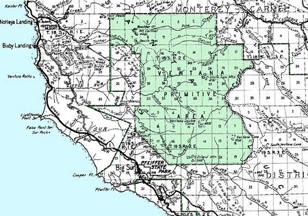
April 18, 1931. Chief Forester Robert Y. Stuart, under the authority Forest Service regulation L-20, provides permanent protection for the Ventana Wild Area; the area was renamed as the Ventana Primitive Area.
December 3, 1936. By an executive order by President Franklin D. Roosevelt, the Santa Barbara National Forest is renamed as Los Padres National Forest.
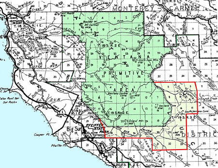
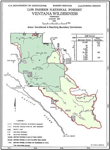
July 28, 1937. By an order by Acting Chief Forester C. E. Rachford, the Ventana Primitive Area is enlarged from about 45,000 acres to about 55,800 acres.
December 1941. The Forest Service issues a special use permit to the Army for about 82,000 acres of land adjacent to the Hunter-Liggett Military Reservation. The land was used for training purposes during World War II.
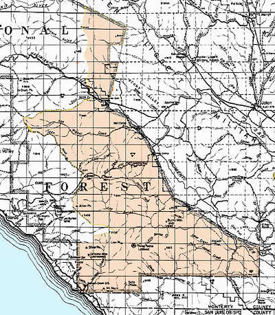
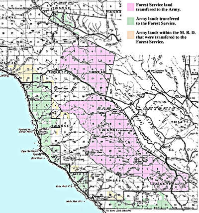
June 4, 1957. By an act of Congress, about 45,700 acres of Forest Service land on the eastern slope of the Coast Ridge south of Cone Peak is transferred to the Army, while about 26,050 acres of Army land, mostly on the western slope of the ridge is transferred to the Forest Service. The Army had acquired the coastal lands during World War II.
September 3, 1964. With the passage of the Wilderness Act, National Forest areas that had been previously designated as "wilderness," "wild" or "canoe" areas are given wilderness status. Areas designated as "primitive" were to be reviewed within ten years, either by the Secretary of Agriculture or the Chief of the Forest Service, for their suitability or unsuitability as wilderness areas.
August 18, 1969. With the passage of the Ventana Wilderness Act, the 55, 800 acre Ventana Primitive Area is abolished, and replaced by the approximately 98,000 acre Ventana Wilderness.
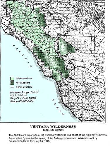
February 24, 1978. With the passage of the Endangered American Wilderness Act, about 61,000 acres are added to the Ventana Wilderness, bringing the total acreage to about 159,000 acres. The additions were known as the Miller Creek-Church Creek Unit, the Tassajara Creek Unit, the Santa Lucia Creek Unit and the Cone Peak-Coast Ridge Unit.
September 28, 1984. With the passage of the California Wilderness Act, the Church Creek Unit, comprised of about 2,750 acres, is added to the Ventana Wilderness.
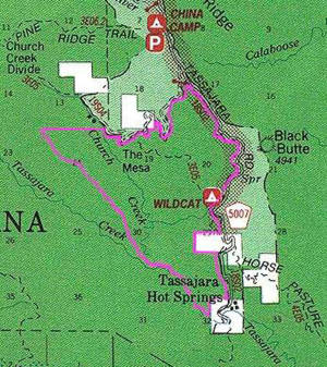
June 19, 1992. With the passage of the Los Padres Condor Range and River Protection Act, the approximately 14,500 acre Silver Peak Wilderness is established, and about 38,800 acres are added to the Ventana Wilderness. The additions to the Ventana Wilderness were known as the Black Butte and Bear Mountain Units. The bill also designated the Big Sur River as a wild and scenic river.
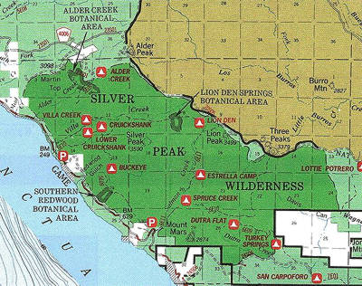
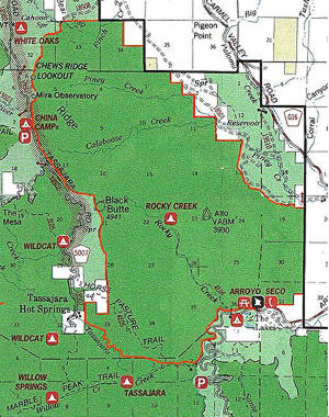
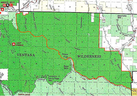
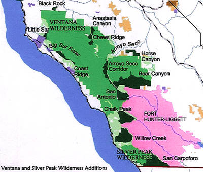
May 9, 2002. A press release announces that Representative Sam Farr will introduce legislation that would designate over 54,000 acres within the Monterey Ranger District as wilderness, with companion legislation in the U. S. Senate to be introduced by Sen. Barbara Boxer. The lands were surveyed, mapped and evaluated for wilderness purposes by members of the Ventana Wilderness Alliance in cooperation with the California Wild Heritage Campaign. The proposal includes ten additions to the Ventana Wilderness and two additions to the Silver Peak Wilderness. The legislation also includes 2,715 acres of proposed wilderness in the nearby Pinnacles National Monument.
The Ventana Wilderness Additions are:
- Anastasia Canyon, 995 acres
- Arroyo Seco Corridor, 3,530 acres
- Bear Canyon, 14,550 acres
- Black Rock, 885 acres
- Chalk Peak, 6,550 acres
- Chews Ridge, 1,345 acres
- Coast Ridge, 2,130 acres
- Horse Canyon, 2,270 acres
- Little Sur, 755 acres
- San Antonio, 4,130 acres
The Silver Peak Wilderness additions are:
- San Carpoforo, 8,235 acres
- Willow Creek, 8,820 acres
NOTE: -- To learn more about the Wilderness Additions of 2002, see the VWA's Wilderness Expansion Project pages.
